
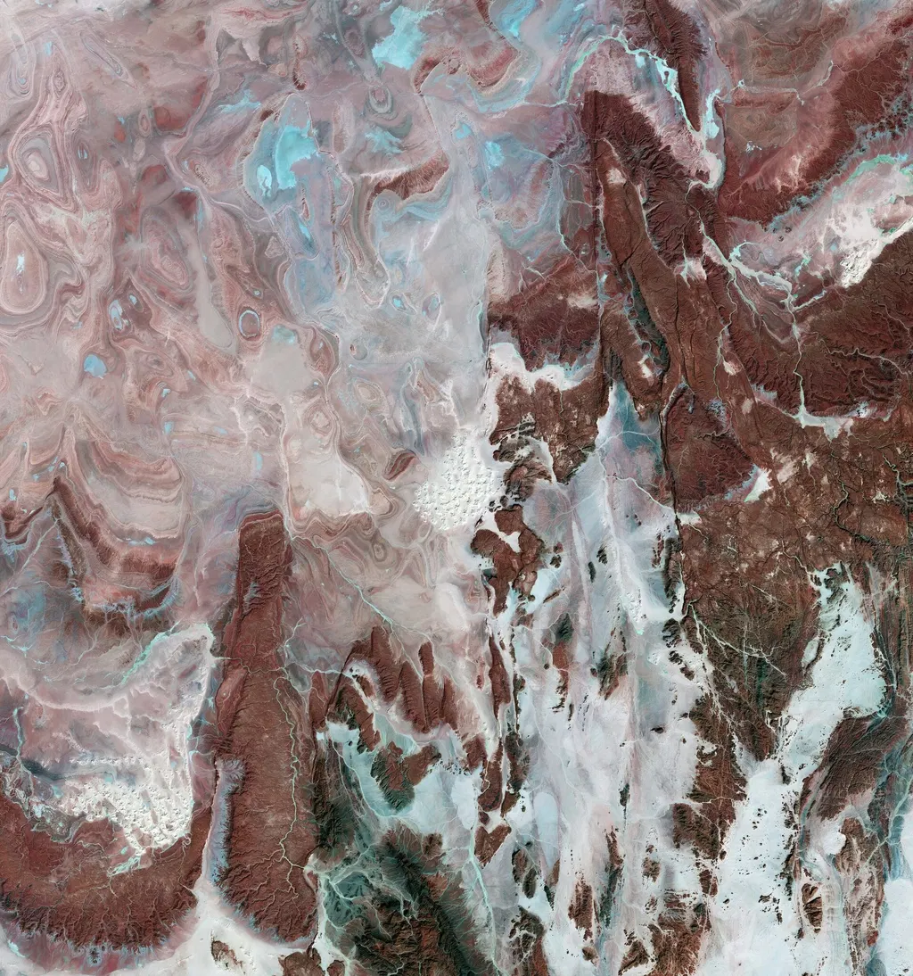
Earth from Space: Algerian arid landscape
The Copernicus Sentinel-2 mission has captured images of the Sahara desert in Algeria, highlighting the Tanezrouft Basin's arid landscape. The images use false color to enhance geological features, revealing patterns of sandstone and salt flats. Additionally, a dust storm that occurred in February 2026 is depicted, showcasing the impact of Saharan dust on air quality.
- ▪The Tanezrouft Basin is one of the most desolate parts of the Sahara desert.
- ▪False color imagery enhances the contrast between different surface materials in arid regions.
- ▪A dust storm in February 2026 significantly affected visibility and air quality in Algeria.
European Space Agency publishes from Europe and files mainly under science. We currently carry 16 of its stories.
Story provenance
Source · retrieval · rights · ranking — open for full record
inspect →
Story provenance
Attribution is not the same as permission. This drawer separates discovery metadata, excerpts, WeSearch-generated summaries, reuse status, and whether the publisher receives the visit. Nothing here claims a legal grant the publisher has not made.
Record
| Original publisher | Esa |
| Canonical URL | https://www.esa.int/ESA_Multimedia/Images/2026/05/Earth_from_Space_Algerian_arid_landscape |
| Publication time | Fri, 22 May 2026 10:00:00 +0200 |
| Retrieval time | 2026-05-22T08:37:01.152Z |
| Last seen | 2026-05-22T08:37:01.152Z |
| Headline source | Publisher (no WeSearch rewrite) |
| Excerpt source | publisher body |
| Excerpt method | First ~120 words (~800 chars) of extracted publisher body, fair-use limited. |
| Summary | WeSearch · cerebras-chat (WeSearch summarizer) |
| Summary source text | contentText |
| Citation coverage | Summary is a WeSearch-generated derivative; primary citation is the original publisher URL. |
| Cluster | Eb1mEsGwjseT |
| Cluster logic | Grouped by semantic title/content similarity across sources within a rolling window. Same-publisher template collisions are excluded from coverage comparison. |
| Ranking reason | Story pages are not engagement-ranked. Hub feeds use recency, with optional source-diversified chronological ordering (cap consecutive stories per source). No personalized ranking. |
| Publisher visit | Yes — open original |
| Substitutes article? | No — link-out required for full text |
Rights status (four layers)
WeSearch handling by dimension
| Indexing | May the item be indexed (stored, ranked, made findable)? | Allowed |
| Snippet | May a short excerpt of the publisher's text be shown? | Allowed |
| AI summary | May WeSearch generate its own short summary of the article? | Limited |
| Retrieval / RAG | May the content be exposed for third-party retrieval-augmented generation? | Not asserted |
| Model training | May the content be used to train AI models? | Not asserted |
| Commercial reuse | May the content be reused commercially? | Not permitted |
Basis: Derived from the published RSS/Atom feed. Contact: [email protected]. Reviewed: 2026-07-24.
Opening excerpt (first ~120 words) tap to expand
The sandy and rocky terrain of the Sahara desert in central Algeria is featured in these images captured by the Copernicus Sentinel-2 mission.The images show the extraordinary landscape within the Tanezrouft Basin, one of the most desolate parts of the Sahara desert. Known for its soaring temperatures and its lack of water and vegetation, the region is often referred to as the ‘Land of Terror’.These two images were processed in false colour by selecting specific spectral bands from the shortwave and near-infrared channels that can be used for classifying and monitoring geological features.
…
Excerpt limited to ~120 words for fair-use compliance. The full article is at Esa.
Discussion
0 commentsMore from Esa


