
How to Place Vertiport Locations in Any City Using Geospatial Machine Learning
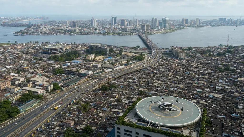
Machine Learning How to Place Vertiport Locations in Any City Using Geospatial Machine Learning A reproducible Lagos case study with population data, transport access, and airspace constraints Abdullahi Dattijo Aug 12, 2026 52 min read Share Illustrative rendering of a rooftop vertiport in Lagos. A vertiport is a small airfield built for aircraft that take off and land straight up and down, such as electric air taxis. If a city has population, road, and airspace data but no reliable information about where people travel, how can we identify the best locations for placing vertiports?
- ▪Machine Learning How to Place Vertiport Locations in Any City Using Geospatial Machine Learning A reproducible Lagos case study with population data, transport access, and airspace constraints Abdullahi Dattijo Aug 12, 2026 52 min read Shar
- ▪A vertiport is a small airfield built for aircraft that take off and land straight up and down, such as electric air taxis.
- ▪If a city has population, road, and airspace data but no reliable information about where people travel, how can we identify the best locations for placing vertiports?
Towards Data Science files mainly under ai. We currently carry 138 of its stories.
Story provenance
Source · retrieval · rights · ranking — open for full record
inspect →
Story provenance
Attribution is not the same as permission. This drawer separates discovery metadata, excerpts, WeSearch-generated summaries, reuse status, and whether the publisher receives the visit. Nothing here claims a legal grant the publisher has not made.
Record
| Original publisher | Towards Data Science |
| Canonical URL | https://towardsdatascience.com/how-to-place-vertiport-locations-in-any-city-using-geospatial-machine-learning/ |
| Publication time | Wed, 12 Aug 2026 12:00:00 +0000 |
| Retrieval time | 2026-08-12T12:06:35.782Z |
| Last seen | 2026-08-12T12:06:35.782Z |
| Headline source | Publisher (no WeSearch rewrite) |
| Excerpt source | publisher body |
| Excerpt method | First ~120 words (~800 chars) of extracted publisher body, fair-use limited. |
| Summary | WeSearch · cerebras-chat (WeSearch summarizer) |
| Summary source text | contentText |
| Citation coverage | Summary is a WeSearch-generated derivative; primary citation is the original publisher URL. |
| Cluster | d_BSeL-fx4Oy · 1 stories |
| Cluster logic | Grouped by semantic title/content similarity across sources within a rolling window. Same-publisher template collisions are excluded from coverage comparison. |
| Ranking reason | Story pages are not engagement-ranked. Hub feeds use recency, with optional source-diversified chronological ordering (cap consecutive stories per source). No personalized ranking. |
| Publisher visit | Yes — open original |
| Substitutes article? | No — link-out required for full text |
Rights status (four layers)
WeSearch handling by dimension
| Indexing | May the item be indexed (stored, ranked, made findable)? | Allowed |
| Snippet | May a short excerpt of the publisher's text be shown? | Allowed |
| AI summary | May WeSearch generate its own short summary of the article? | Limited |
| Retrieval / RAG | May the content be exposed for third-party retrieval-augmented generation? | Not asserted |
| Model training | May the content be used to train AI models? | Not asserted |
| Commercial reuse | May the content be reused commercially? | Not permitted |
Basis: Derived from the published RSS/Atom feed. Contact: [email protected]. Reviewed: 2026-07-24.
Opening excerpt (first ~120 words) tap to expand
Machine Learning How to Place Vertiport Locations in Any City Using Geospatial Machine Learning A reproducible Lagos case study with population data, transport access, and airspace constraints Abdullahi Dattijo Aug 12, 2026 52 min read Share Illustrative rendering of a rooftop vertiport in Lagos. Image by author. A vertiport is a small airfield built for aircraft that take off and land straight up and down, such as electric air taxis. If a city has population, road, and airspace data but no reliable information about where people travel, how can we identify the best locations for placing vertiports? That is the situation in Lagos, Nigeria, and in many fast-growing cities. The first attempt is obvious: use the population map, find the busiest areas, and place proposed vertiports there.
…
Excerpt limited to ~120 words for fair-use compliance. The full article is at Towards Data Science.
Discussion
0 commentsMore from Towards Data Science