LAGEOS: An Earth Science Mission Built for Enduring Precision
Launched on May 4, 1976, the Laser Geodynamics Satellite (LAGEOS) was the first satellite dedicated to laser ranging studies, orbiting 3,700 miles above Earth. Its 426 retroreflectors allow ground stations to measure distances with millimeter precision, enabling long-term tracking of tectonic plate movements and Earth's shape. Despite its age, LAGEOS remains operational and is expected to stay in orbit for millions of years due to its durable, maintenance-free design.
- ▪LAGEOS was launched on May 4, 1976, and is one of the oldest scientific satellites still in operation.
- ▪The satellite carries 426 retroreflectors that reflect laser pulses back to Earth for precise distance measurements.
- ▪Scientists use LAGEOS data to monitor tectonic plate motion, Earth's shape, and gravity field models.
- ▪LAGEOS II, launched in 1992 by the Italian Space Agency, complements the original satellite's measurements.
- ▪The satellite's dense brass core and spherical design contribute to its stable, long-lasting orbit.
Opening excerpt (first ~120 words) tap to expand
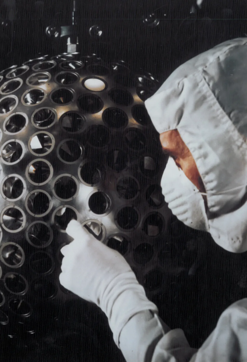
2 min readLAGEOS: An Earth Science Mission Built for Enduring PrecisionNASA History OfficeNASA History OfficeMay 04, 2026 Article Technicians at NASA’s Goddard Space Flight Center helped complete prelaunch testing of the Laser Geodynamic Satellite (LAGEOS). LAGEOS was the first satellite devoted exclusively to laser ranging studies. NASA/Goddard Space Flight Center On May 4, 1976, a spacecraft resembling a disco ball entered orbit almost 3,700 miles (6,000 kilometers) above Earth. This shiny, two‑foot‑wide (60‑centimeter) sphere called the Laser Geodynamics Satellite, or LAGEOS, is covered with 426 retroreflectors—small mirrored prisms designed to bounce laser light directly back to where it came from.
…
Excerpt limited to ~120 words for fair-use compliance. The full article is at NASA.
Discussion
0 commentsMore from NASA