Fires Rage in Georgia
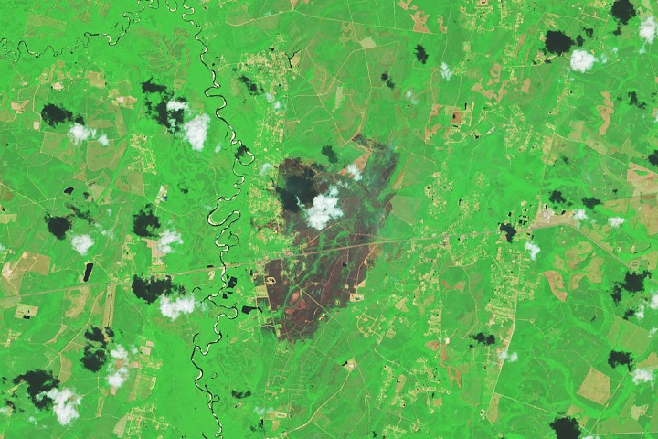
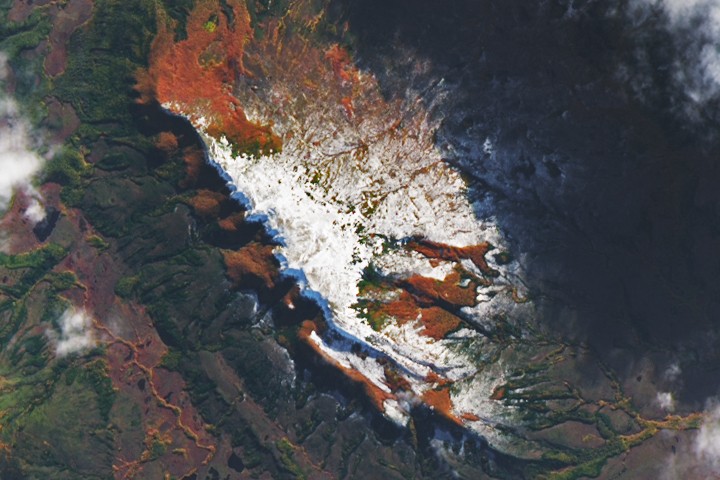
Two large wildfires—the Highway 82 and Pineland Road fires—burned over 50,000 acres in southern Georgia in April 2026, fueled by extreme drought and debris from Hurricane Helene. The fires, both human-caused, destroyed more than 120 homes, the most in state history, amid strong winds and dry conditions. Firefighters made some progress with containment aided by recent rains, but hundreds remained deployed to combat the blazes. Satellite data from NASA and the USGS helped monitor fire spread and support response efforts.
Opening excerpt (first ~120 words) tap to expand
Earth ObservatoryScienceEarth ObservatoryFires Rage in GeorgiaEarthEarth ObservatoryImage of the DayEO ExplorerTopicsAll TopicsAtmosphereLandHeat & RadiationLife on EarthHuman DimensionsNatural EventsOceansRemote Sensing TechnologySnow & IceWaterMore ContentCollectionsGlobal MapsWorld of ChangeArticlesNotes from the Field BlogEarth Matters BlogBlue Marble: Next GenerationEO KidsMission: BiomesAboutAbout UsSubscribe🛜 RSSContact UsSearch 3 min readFires Rage in GeorgiaImage of the Day for April 29, 2026Firefighters are battling two destructive blazes in the southern part of the state as drought grips the U.S. Southeast.
…
Excerpt limited to ~120 words for fair-use compliance. The full article is at NASA.
Discussion
0 commentsMore from NASA