
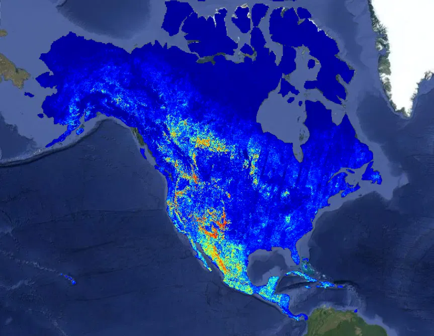
The OlmoEarth Platform: Geospatial inference at planetary scale
Governments, NGOs, and other mission-driven organizations are already adapting OlmoEarth for applications including deforestation monitoring, food security, and wildfire risk. At Ai2, we know how to train and release powerful open models, and for organizations with strong engineering teams, an open model is all they need to run with. But most organizations in the environmental space – the ones best placed to apply these models – don't have the infrastructure or engineering teams that can manage the full lifecycle: labeling data, fine-tuning models, and running large-scale inference.
- ▪Governments, NGOs, and other mission-driven organizations are already adapting OlmoEarth for applications including deforestation monitoring, food security, and wildfire risk.
- ▪At Ai2, we know how to train and release powerful open models, and for organizations with strong engineering teams, an open model is all they need to run with.
- ▪But most organizations in the environmental space – the ones best placed to apply these models – don't have the infrastructure or engineering teams that can manage the full lifecycle: labeling data, fine-tuning models, and running large-sca
Hugging Face Blog files mainly under ai. We currently carry 40 of its stories.
Story provenance
Source · retrieval · rights · ranking — open for full record
inspect →
Story provenance
Attribution is not the same as permission. This drawer separates discovery metadata, excerpts, WeSearch-generated summaries, reuse status, and whether the publisher receives the visit. Nothing here claims a legal grant the publisher has not made.
Record
| Original publisher | Hugging Face - Blog |
| Canonical URL | https://huggingface.co/blog/allenai/olmoearth-infrastructure |
| Publication time | Tue, 28 Jul 2026 16:27:42 GMT |
| Retrieval time | 2026-07-28T16:35:32.170Z |
| Last seen | 2026-07-28T16:35:32.170Z |
| Headline source | Publisher (no WeSearch rewrite) |
| Excerpt source | publisher body |
| Excerpt method | First ~120 words (~800 chars) of extracted publisher body, fair-use limited. |
| Summary | WeSearch · cerebras-chat (WeSearch summarizer) |
| Summary source text | contentText |
| Citation coverage | Summary is a WeSearch-generated derivative; primary citation is the original publisher URL. |
| Cluster | qi-orDtC00pR |
| Cluster logic | Grouped by semantic title/content similarity across sources within a rolling window. Same-publisher template collisions are excluded from coverage comparison. |
| Ranking reason | Story pages are not engagement-ranked. Hub feeds use recency, with optional source-diversified chronological ordering (cap consecutive stories per source). No personalized ranking. |
| Publisher visit | Yes — open original |
| Substitutes article? | No — link-out required for full text |
Rights status (four layers)
WeSearch handling by dimension
| Indexing | May the item be indexed (stored, ranked, made findable)? | Allowed |
| Snippet | May a short excerpt of the publisher's text be shown? | Allowed |
| AI summary | May WeSearch generate its own short summary of the article? | Limited |
| Retrieval / RAG | May the content be exposed for third-party retrieval-augmented generation? | Not asserted |
| Model training | May the content be used to train AI models? | Not asserted |
| Commercial reuse | May the content be reused commercially? | Not permitted |
Basis: Derived from the published RSS/Atom feed. Contact: [email protected]. Reviewed: 2026-07-24.
Opening excerpt (first ~120 words) tap to expand
Back to Articles The OlmoEarth Platform: Geospatial inference at planetary scale Enterprise Article Published July 28, 2026 Upvote - Kyle Wiggers Ai2Comms Follow allenai Why satellite inference is challenging The right hardware for the right task One request, hundreds of workers, and thousands of processes Finding and fetching the right pixels Handling failure at scale Where we're headed 🌍 Learn more about OlmoEarth Platform: https://allenai.org/olmoearth The OlmoEarth models are our family of Earth observation foundation models, pretrained on roughly 10 terabytes of multimodal satellite data. Governments, NGOs, and other mission-driven organizations are already adapting OlmoEarth for applications including deforestation monitoring, food security, and wildfire risk.
…
Excerpt limited to ~120 words for fair-use compliance. The full article is at Hugging Face - Blog.
Discussion
0 commentsMore from Hugging Face - Blog