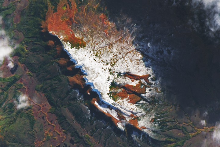
Winter’s End Is Written in the Clouds

A NASA satellite captured a striking image of diverse cloud formations over the Gulf of Alaska on March 19, 2026, marking the end of a stormy winter. The cloud patterns, including cloud streets, open-cell clouds, von Kármán vortex streets, and a polar low, resulted from atmospheric instability caused by cold Arctic air moving over warmer ocean waters. Despite warming trends by late April, additional wet and stormy weather was expected as an atmospheric river approached southern Alaska.
Opening excerpt (first ~120 words) tap to expand
Earth ObservatoryScienceEarth ObservatoryWinter’s End Is Written in...EarthEarth ObservatoryImage of the DayEO ExplorerTopicsAll TopicsAtmosphereLandHeat & RadiationLife on EarthHuman DimensionsNatural EventsOceansRemote Sensing TechnologySnow & IceWaterMore ContentCollectionsGlobal MapsWorld of ChangeArticlesNotes from the Field BlogEarth Matters BlogBlue Marble: Next GenerationEO KidsMission: BiomesAboutAbout UsSubscribe🛜 RSSContact UsSearch 3 min readWinter’s End Is Written in the CloudsImage of the Day for April 30, 2026As winter turned to spring, the skies over the Gulf of Alaska displayed textbook examples of numerous cloud formations.
…
Excerpt limited to ~120 words for fair-use compliance. The full article is at NASA.
Discussion
0 commentsMore from NASA